The development of UCSD's AGILE Netowrk
UC San Diego’s Bioregional Center has recently been working to develop UC San Diego’s AGILE Network. Advocating Green Infrastructure for Learning and Equity has conducted three surveys configured as distinct Asset Maps. These have been developed through 2020 and early 2021 in collaboration with the UC system-wide Global Food Initiative (GFI). 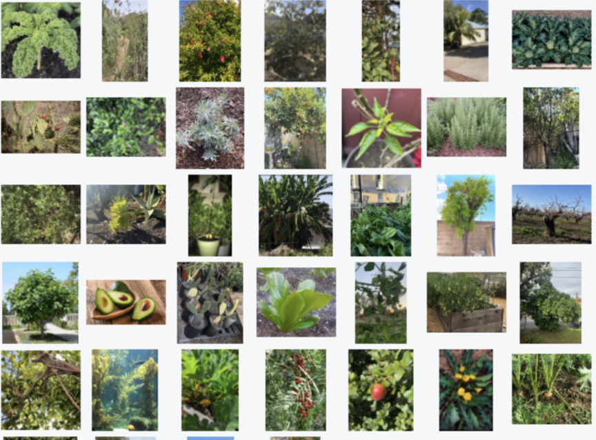
One shows all faculty and researchers at UC San Diego who are studying food and/or food systems in one form or another. The Asset Map in this case sheds light on the faculty and researchers, including their published work, affiliations, and collaborative relationships (see UC San Diego CCC Faculty-Researcher Asset Map). The Asset Map also includes relevant campus centers and projects, and lets faculty update their profiles and define what they would offer to and need from GFI.
The second and third surveys were both created through citizen science—by crowdsourcing data that UC San Diego students generated as part of their academic course work. Both of these surveys geolocate, map, and register for analytical purposes green infrastructure assets supporting food systems. Specifically, one focused on documenting the site suitability of vacant land for urban agriculture (see Vacant Lot Survey), the other focused on wild and cultivated edible plants described within their particular foodscapes (e.g., community gardens, urban farms, large farms in the rural working landscape), see Foodscape Survey.
The AGILE Network grows out of six years of experience that UC San Diego’s Bioregional Center for Sustainability Science, Planning and Design —together with our main community partner, the Global Action Research Center (Global ARC, 501ce)—has gained while creating civically engaged, experiential learning opportunities for hundreds of students.
The AGILE team is bringing together a diverse group of faculty, students, staff, and community partners. The motivation for doing this is fueled by two significant trends: (1) the growing demand among Faculty, Researchers, Departments, and Colleges for meaningful and accessible experiential learning opportunities that improve pedagogy and students’ education; and (2) the heightening degree of emphasis that researchers and funding agencies (e.g., NSF, NIH, USDA, EPA) are placing on civic-engagement (e.g., community science) as key to enabling problem-solving, solutions-oriented approaches that embrace integrated systems research (e.g., convergence research) in contradistinction to exceedingly reductionist, siloed, fragmented disciplinary approaches to urgent societal challenges.
AGILE is a work in progress, a long-range endeavor, to integrate data and stories for urban and bioregional planning focused on five types of green (and blue*) infrastructure:
- Community Gardens
- Tree Canopy (including food forests)
- Farms (urban, peri-urban, rural)
- Agrotecture (e.g., green roofs, aquaculture, agrihoods)
- Terrestrial and Aquatic Ecosystems (landscapes and waterscapes that generate multiple beneficial services for human and other life forms)
*Some use the term blue infrastructure to differentiate terrestrial from aquatic features. For ease of reference, we simply consider Blue GI to be included within Green GI.
The first three categories of GI (Community Gardens, Trees, Farms) are commonly understood. Agrotecture is less familiar term in discussions about green infrastructure; it is akin to Agritecture which shows up in professional circles. Agritecture typically refers to big business connected to agricultural consulting, planning, building, be it for large-scale farms, or consulting those engaged in large-scale farming. Agrotecture, on the other hand, refers to the agricultural activity of an area with a particular focus on spatial (local and regional) built and design aspects of food systems. Agrotecture synergistically integrates some combination of land, water, ecosystems, buildings, and/or infrastructure to intentionally improve how human and natural systems interact in particular places. More specifically, Agrotecture aims to improve one or more intersecting aspects of urban, peri-urban, and/or rural agriculture, such as culture, nutrition, health, safety, aesthetics, sensory experiences, access, production, processing, marketing, consumption, biodiversity, soil regeneration, carbon sequestration, waste recovery.
As practiced in some places, Agroteture is a movement with significant indigenous roots. One such “Design Movement,” referred to as Lo-TEK calls for rebuilding an “understanding of indigenous philosophy and vernacular architecture that generates sustainable, climate-resilient infrastructures.” TEK is an acronym for Traditional Ecological Knowledge; “a cumulative body of multigenerational knowledge, practices, and beliefs, countering the idea that indigenous innovation is primitive and exists isolated from technology. It is sophisticated and designed to sustainably work with complex ecosystems” (source, also see video).
The fifth category (Terrestrial and Aquatic Ecosystems) does not necessarily involve food systems directly; though the linkage of ecosystem services to food systems is a connection we will give particular attention to. The degree to which humans intentionally intervene to enhance ecosystem services provided by landscapes and waterscapes varies from a little to a lot. Ecosystem services provide people with many benefits including provisioning services (e.g., food and water), regulating services (e.g., flood and disease control), cultural services (e.g., spiritual, recreational, and cultural enrichment); and supporting services (e.g., nutrient cycling, pollination, bioremediation) (source).